Home
Where Is the Fire in So Cal Right Now? Live Maps and Alerts
If you are in an emergency situation, dial 911 immediately. For real-time tracking, use these verified resources:
As of September 2026, Southern California continues to face a complex wildfire landscape. Following a challenging start to the previous year, where over 60,000 acres were consumed by early season blazes, residents must remain vigilant. The current environmental conditions, characterized by persistent drought cycles and the onset of seasonal wind events, make real-time information a critical component of public safety. This resource hub provides the technical tools and hyper-local data necessary to navigate the 2026 fire season with professional-grade accuracy.
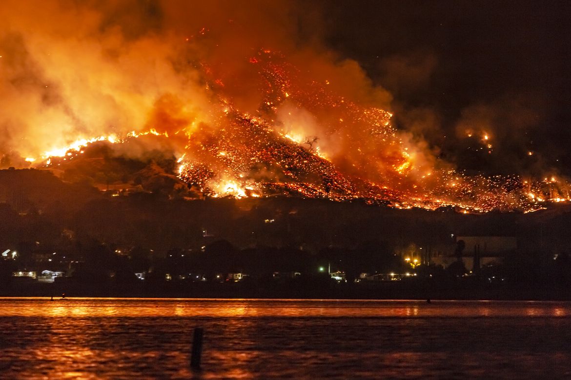
Image source: Newsroom | UCLA
How to Track Southern California Wildfires in Real Time
Tracking a wildfire in Southern California requires more than just watching the local news. Modern firefighting utilizes a "Tech Stack" approach, combining satellite imagery, aerial reconnaissance, and ground-based sensors. To get the most accurate picture, you should synthesize data from multiple official sources rather than relying on a single map.
Use the CAL FIRE Incident Dashboard for Official Data
The CAL FIRE Incident Dashboard stands out as a top choice for verified information. This is the official "Source of Truth" for containment percentages, acreage burned, and resource allocation. However, users should be aware of the 10-Acre Rule . CAL FIRE typically prioritizes reporting for incidents that exceed 10 acres or involve significant threats to structures. If you see smoke from a small brush fire in your neighborhood that isn't on the map yet, it may still be in the initial attack phase or below the reporting threshold.
Monitor FIRIS for 3-Hour Fire Spread Forecasts
The Fire Integrated Real-Time Intelligence System (FIRIS) is a significant advancement in fire tracking. Unlike static maps that show where a fire has been, FIRIS uses aircraft-mounted infrared sensors to create 3-hour spread models. These models predict where the fire is likely to move based on current wind speeds, fuel moisture, and topography. For residents in canyon communities, FIRIS data is often more actionable than standard perimeter maps because it accounts for the rapid "spotting" behavior common in Southern California.
View Satellite Heat Detections via NASA and WFCA
For the earliest possible detection, satellite data from GOES, VIIRS, and MODIS provides near real-time heat signatures. The WFCA Fire Map integrates these satellite feeds with AI-confirmed detections. This technology helps filter out "false positives" from industrial heat sources, such as refineries or power plants, which can sometimes appear as fire hotspots on raw satellite feeds. Satellite tracking is particularly useful during the first 30 minutes of an ignition before ground crews can establish a perimeter.
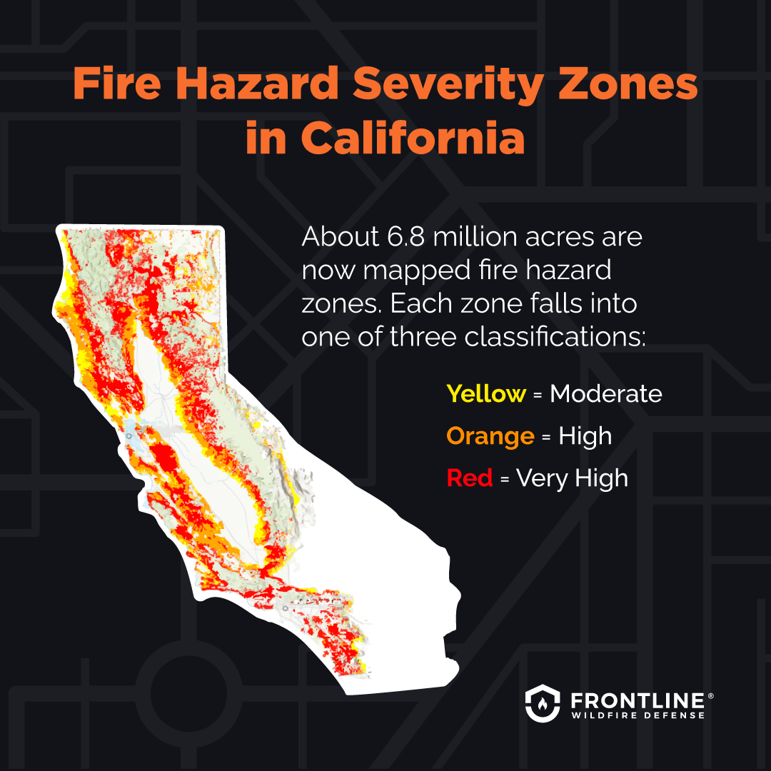
Image source: Frontline Wildfire Defense
Sign Up for Your Specific County Emergency Alerts
In Southern California, emergency management is highly fragmented. A fire burning in the Santa Monica Mountains might cross from Los Angeles County into Ventura County, requiring alerts from two different systems. Relying on social media is risky due to algorithm delays; direct SMS and voice alerts are the most effective way to receive evacuation orders.
One-Click Alert Directory for Southern California
Every resident should be registered for their specific county's mass notification system. These systems use geofencing to send alerts only to those in the direct path of danger. Below are the primary registration portals for the region:
- Los Angeles County: Register via Alert LA County for localized evacuation notices.
- Orange County: Use AlertOC , which is managed by the Sheriff's Department.
- Ventura County: Sign up for VC Alert to receive notifications for coastal and inland fires.
- San Diego County: Download the SD Emergency App and register for AlertSanDiego.
- Inland Empire: Residents in Riverside and San Bernardino should use RivCoReady and the TLO system.
Use PulsePoint to See Incidents Before They Hit the News
PulsePoint is a mobile application that links directly to 911 dispatch systems. By following local agencies like "LAFD" or "OCFA," you can see "Vegetation Fire" dispatches the moment they are keyed in by operators. This often provides a 15-to-30-minute head start over traditional news outlets. You can even listen to live radio traffic to hear how commanders are describing the fire's behavior—whether it has a "rapid rate of spread" or if "extra resources" are being requested.
Understanding the 2026 Southern California Fire Outlook
The 2026 season is shaped by a combination of long-term fuel accumulation and specific weather patterns. While summer heat is a factor, the most dangerous periods in Southern California typically occur during the transition to autumn, when vegetation is at its driest and offshore winds begin to blow.
Why Santa Ana Winds Are the Primary Threat
Santa Ana winds are high-pressure systems that push air from the Great Basin toward the Pacific Coast. As this air drops in elevation through the mountain passes, it compresses, heats up, and loses moisture. By the time it reaches the canyons of Malibu or Orange County, humidity levels can drop below 5%, and wind gusts can exceed 60 mph. These winds do not just push the flames; they carry embers miles ahead of the fire front, starting new ignitions that can trap residents who believe they are safe.
New Fire Hazard Severity Zone Maps for 2026
As of early 2026, California has fully implemented the revised Fire Hazard Severity Zone (FHSZ) maps. These maps, the first major update in over a decade, identify approximately 6.8 million acres as high-risk zones. The 2026 updates utilize high-resolution LiDAR mapping to identify "snow crush"—areas where heavy winter precipitation in previous years caused branches to break and accumulate on the forest floor, creating a dense layer of dry fuel that traditional satellite mapping often misses.
Increased Staffing and Type-6 Engines in SoCal
According to recent data from the Office of the Governor , CAL FIRE staffing has reached a historic high of 10,741 positions. A significant portion of this growth is focused on Southern California's unique topography. The state has deployed new Type-6 Engines specifically for the region. These are 4WD units that carry 300 gallons of water and are designed to navigate the narrow, steep fire roads of the Santa Monica and Santa Ana mountains where traditional, heavy fire engines cannot fit.
| Feature | CAL FIRE Incident Map | NASA/WFCA Satellite Map |
|---|---|---|
| Data Source | Ground crews & aerial surveys | GOES/VIIRS Satellites |
| Update Frequency | Periodic (often hourly) | Near real-time (5-15 mins) |
| Accuracy | High (Verified perimeters) | Moderate (May show false heat) |
| Best Use | Confirming containment & evacuations | Early detection of new starts |
What Is the Difference Between Contained and Controlled?
One of the most common points of confusion for residents is the terminology used in official reports. Hearing that a fire is "50% contained" does not mean the fire is half extinguished. Understanding these nuances can help you make better decisions about when it is safe to return home.
Why 100 Percent Containment Does Not Mean the Fire Is Out
Containment refers to the establishment of a fuel break—such as a cleared dirt line, a road, or a hose line—around the entire perimeter of the fire. A fire can be 100% contained while still having active flames and intense heat in the interior. Controlled , on the other hand, means the fire is completely extinguished and the containment lines are secure enough that the fire is unlikely to jump them. The process between containment and control is known as "Mop-Up," where firefighters physically stir the soil and douse hotspots to ensure no embers remain.
"Containment is a measure of the line around the fire; Control is a measure of the fire's ability to escape that line. Residents should remain alert until a fire is declared controlled." — CAL FIRE Operational Guidelines
Essential Safety Actions for Residents
Wildfire safety is a year-round responsibility in Southern California. While tracking the fire is important, the actions you take before a fire starts—and the way you handle small ignitions—can prevent a disaster.
The Douse-Stir-Douse Method for Fire Prevention
Human activity remains a leading cause of wildfires. If you are managing a small debris burn or a campfire (where permitted), the U.S. Department of the Interior recommends the "Douse-Stir-Douse" method to ensure total extinguishment:
- Douse: Flood the area with water until all embers are submerged.
- Stir: Use a shovel to stir the coals and ash, ensuring the water reaches the bottom layer.
- Douse Again: Add more water to the stirred mixture.
- The Touch Test: The ground and remains must be cold to the touch before you leave the area.
Create a 100-Foot Defensible Space Buffer
Your home's ability to survive a wildfire depends largely on the "Defensible Space" you maintain. This is divided into three critical zones:
- Zone 0 (0-5ft): The "Ember-Resistant" zone. Remove all flammable vegetation, wood mulch, and stored items from directly against the house.
- Zone 1 (5-30ft): The "Lean, Clean, and Green" zone. Remove all dead weeds and grass. Keep trees trimmed so branches are at least 10 feet from other trees.
- Zone 2 (30-100ft): The "Reduced Fuel" zone. Mow grass to a maximum height of 4 inches and create horizontal and vertical spacing between shrubs and trees.
Vehicle Safety in Dry Brush
Many Southern California fires start along roadsides. A vehicle's exhaust system can reach temperatures exceeding 1,000 degrees Fahrenheit. If you pull over onto dry grass, the heat from your catalytic converter can ignite a fire in seconds. Always stay on paved surfaces or cleared dirt turnouts, and ensure that trailer chains are not dragging, as sparks from metal-on-asphalt are a frequent ignition source during Red Flag conditions.
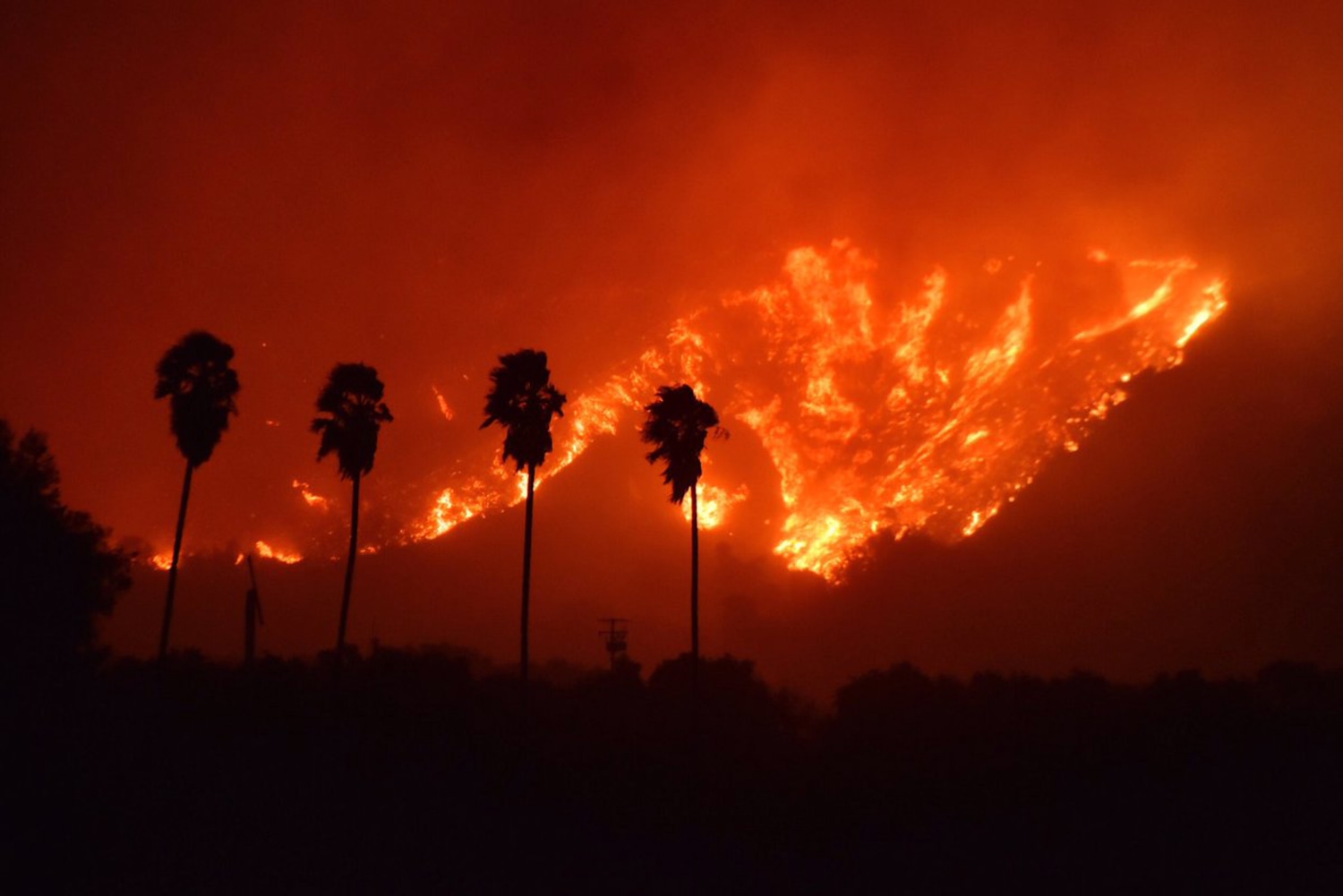
Image source: NBC News
Road Closures and Air Quality Monitoring
During an active fire, the danger extends far beyond the flames. Smoke inhalation and gridlocked evacuation routes pose significant risks to public health and safety.
Track Caltrans QuickMap for Evacuation Routes
When an evacuation order is issued, do not rely on standard GPS apps like Google Maps or Waze, as they may direct you onto narrow side streets that are reserved for emergency vehicles. Instead, use Caltrans QuickMap . Filter the map for "Full Closures" and "Fire" icons to see the official routes designated by the California Highway Patrol. Following these routes ensures you are moving away from the fire and toward established shelters.
Monitor the Air Quality Index (AQI) During Smoke Events
Wildfire smoke contains PM2.5—fine particulate matter that can penetrate deep into the lungs. Even if a fire is 50 miles away, shifting winds can bring hazardous air to your neighborhood. Use AirNow.gov for official regional data, or PurpleAir for hyper-local sensors. If the AQI exceeds 150 (Unhealthy), you should stay indoors with windows closed and run an air purifier with a HEPA filter. If you must go outside, only an N95 or P100 respirator provides adequate protection; cloth masks and surgical masks do not filter out smoke particles.
Frequently Asked Questions
Where can I see a live map of fires near me?
The most reliable live maps are the CAL FIRE Incident Map for official perimeters and the WFCA Fire Map for real-time satellite heat detections. For the most immediate "neighborhood-level" awareness, the PulsePoint app shows 911 dispatches for vegetation fires as they happen, often before they appear on any map.
What does a Red Flag Warning mean in Southern California?
A Red Flag Warning is issued by the National Weather Service when weather conditions are highly conducive to extreme fire behavior. In SoCal, this typically means a combination of humidity below 15%, sustained winds over 25 mph, and dry fuels. During these times, any ignition has the potential to become a major conflagration very quickly.
How do I find out if I am under an evacuation order?
Official evacuation orders are communicated through county alert systems (like Alert LA or AlertOC) and the local Sheriff's Department social media accounts. An "Evacuation Order" means there is an immediate threat to life and you must leave now. An "Evacuation Warning" means you should prepare to leave at a moment's notice.
Why is there smoke in SoCal if there is no fire nearby?
Southern California's geography often traps smoke from fires hundreds of miles away. Upper-level winds can carry smoke from Northern California or the Sierra Nevada into the LA Basin. Check the AQI and wind direction charts on AirNow.gov to determine if the smoke is from a local incident or distant drift.
What should I pack in a 5-minute evacuation bag?
A "Go-Bag" should include the "6 P's": 1. People and Pets (including leashes/carriers). 2. Papers (deeds, passports, insurance). 3. Prescriptions (medications and glasses). 4. Pictures (irreplaceable mementos). 5. Personal Computers (hard drives/laptops). 6. Plastic (credit cards and cash). Keep these items in a central location during high-risk weather.
Key Takeaways for Fire Safety
- Official Sources: Bookmark the CAL FIRE Incidents page for verified containment and acreage stats.
- Early Warning: Download PulsePoint to monitor 911 dispatch calls for vegetation fires in real time.
- County Alerts: Register for your specific County Alert system (AlertLA, AlertOC, etc.) to receive geofenced evacuation orders.
- Predictive Tech: Check FIRIS during active fires for 3-hour spread models that predict where the fire is heading.
- Defensible Space: Maintain 100 feet of clearance around your home to increase its chances of surviving an ember storm.
- Smoke Protection: Use AirNow.gov to track AQI and wear an N95 mask if you must be outdoors during smoke events.
In Southern California, wildfire awareness is a year-round necessity; staying informed through these professional tools is your most effective defense against the unpredictable nature of the 2026 fire season.
All trademarks, copyrighted content, and quoted material referenced in this article belong to their respective owners. Brief excerpts are used under fair use (17 U.S.C. § 107) for purposes of commentary, criticism, and informational reporting. This article is not affiliated with or endorsed by CAL FIRE or any government agency.