Home
How to Navigate New Orleans Using Local Maps and Neighborhood Guides
Navigating New Orleans requires understanding the city's unique "Local Compass." Instead of cardinal directions, locals use Lakeside (toward Lake Pontchartrain), Riverside (toward the Mississippi River), Uptown (upriver), and Downtown (downriver). For the most efficient travel between major hubs like the French Quarter and the Garden District, the St. Charles Streetcar ranks among the top choices for both scenery and utility. Travelers should use the official Le Pass app for real-time transit tracking and consult the NOPD Community Crime Map for data-driven safety awareness.
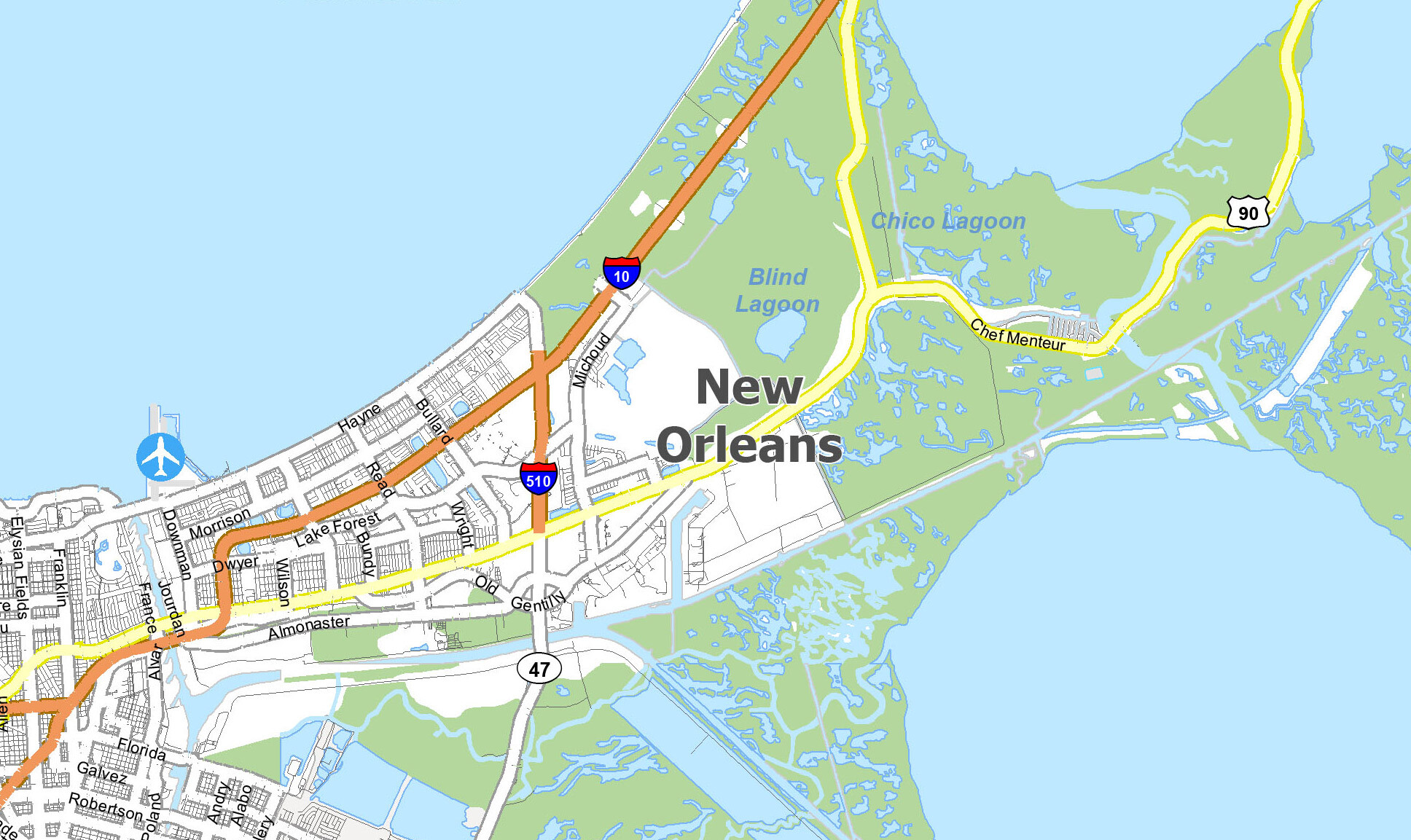
Image source: GIS Geography
Understanding the New Orleans Layout Using the Local Compass
When you open a standard digital map of New Orleans, your instinct is to look for North, South, East, and West. However, in the "Crescent City," these cardinal directions often lead to confusion. Because the Mississippi River curves in a deep U-shape around the historic core, a street that runs "North" in one neighborhood might be running "West" just three miles away. To solve this, New Orleans developed a directional system based on its most prominent landmarks: the river and the lake.
According to NewOrleans.com , locals rely on a four-point system that aligns with the city's geography rather than the magnetic pole. Understanding these terms is essential for following local directions or reading neighborhood-specific maps.
- Lakeside
- Moving away from the Mississippi River toward Lake Pontchartrain. If you are standing in the French Quarter and walking toward I-10, you are heading Lakeside.
- Riverside
- Moving toward the Mississippi River. This is the direction of the Moonwalk, the Aquarium, and the many wharves lining the water.
- Uptown
- Moving "upriver" or against the flow of the Mississippi. This generally refers to heading toward the Garden District, Tulane University, and Audubon Park.
- Downtown
- Moving "downriver" or with the flow of the Mississippi. This includes the Central Business District (CBD), the French Quarter, and the Marigny.
This "Local Compass" is more than just a linguistic quirk; it is a functional necessity. When a local tells you a shop is on the "Uptown Lakeside corner" of an intersection, they are giving you a precise coordinate that bypasses the confusion of the river's curve. As you explore, you will notice that even the street signs in historic districts sometimes reflect this orientation.
Exploring the Most Popular Neighborhoods on the New Orleans Map
New Orleans is a city of distinct "faubourgs" (suburbs or neighborhoods), each with its own architectural style, elevation, and cultural atmosphere. Understanding the boundaries of these areas helps travelers plan efficient walking routes and choose the right home base for their stay.
The French Quarter (Vieux Carré)
Founded in 1718, the French Quarter is the historic heart of the city. On a map, it is a perfect grid bounded by Canal Street, Esplanade Avenue, Rampart Street, and the Mississippi River. While Bourbon Street is the most famous thoroughfare, Royal Street offers a more curated experience with antique shops and art galleries. Jackson Square, anchored by the St. Louis Cathedral, serves as the central landmark for this district.
The Garden District
Located Uptown, the Garden District is widely regarded as one of the most beautiful residential areas in the United States. It is famous for its well-preserved 19th-century mansions and massive live oak trees. The neighborhood is bounded by St. Charles Avenue and Magazine Street. A key map marker here is Lafayette Cemetery No. 1, one of the city's famous "Cities of the Dead."
CBD & Warehouse District
The Central Business District (CBD) is the modern hub of the city. It houses the Caesars Superdome, the Smoothie King Center, and the National WWII Museum. The Warehouse District, a sub-section of the CBD, has transitioned from industrial roots into a trendy area filled with art lofts and high-end eateries. It is a top choice for those who want proximity to the French Quarter without the constant noise of the tourist crowds.
Marigny & Bywater
Just downriver from the French Quarter lies the Faubourg Marigny. This neighborhood is the epicenter of the local music scene, specifically along Frenchmen Street. Further downriver is the Bywater, a bohemian enclave known for colorful Creole cottages and street art. These areas offer a more local perspective of the city's creative pulse.
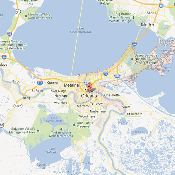
Image source: Tour Louisiana
Which New Orleans Neighborhood Should You Stay In?
Choosing where to stay depends on your priorities regarding noise, walkability, and access to transit. The following framework compares the most popular districts to help you make an informed decision based on current travel trends.
| Neighborhood | Vibe | Walkability | Noise Level | Best For |
|---|---|---|---|---|
| French Quarter | High Energy / Historic | Excellent | High | First-time visitors |
| Garden District | Quiet / Scenic | Good | Low | Couples & Architecture fans |
| CBD / Warehouse | Modern / Urban | High | Moderate | Business & Museums |
| Marigny / Bywater | Arts / Local | Moderate | Moderate | Live Music lovers |
| Mid-City | Residential / Green | Low | Low | Families & Park access |
While the French Quarter offers the most convenience for sightseeing, many frequent visitors find that the Warehouse District or the Garden District provides a more balanced experience. According to Downtown NOLA , the CBD has seen significant growth in boutique hotels that cater to travelers looking for modern amenities within historic structures.
How to Use the New Orleans Streetcar System for Easy Travel
The New Orleans streetcar system is more than just a tourist attraction; it is a vital part of the city's transit infrastructure. The system consists of four main lines, each offering a different perspective of the city's geography.
- St. Charles Line (Green Cars): This is the world’s oldest continuously operating streetcar line, running since 1835. It travels from the CBD, through the Garden District, and all the way to the Carrollton neighborhood. It is a top-rated way to see the historic mansions of Uptown.
- Canal Street Line (Red Cars): This line runs from the foot of Canal Street at the river and splits into two branches: one heading to the historic cemeteries (Cities of the Dead) and the other to City Park and the New Orleans Museum of Art.
- Rampart/St. Claude Line: This newer line connects the French Quarter to the Marigny and Bywater, making it easier for visitors to access the music clubs on Frenchmen Street.
- Riverfront Line: A short but scenic route that runs along the Mississippi River, connecting the French Market to the Aquarium and the Convention Center.
For the most seamless experience, travelers should download the Le Pass app . This official application allows you to purchase fares digitally and view real-time maps of where each streetcar is currently located. This is particularly helpful during peak festival seasons when schedules may be adjusted due to parades or crowds.
Staying Safe by Using Real-Time City Data and Safety Maps
Safety is a common concern for any traveler visiting a major urban center. Rather than relying on anecdotal evidence, savvy travelers can use official data provided by the City of New Orleans to maintain situational awareness. The city maintains several dashboards that offer transparency into public safety and infrastructure.
The LexisNexis Community Crime Map , which integrates with NOPD data, allows users to see recent activity in specific blocks. It is important to note that high-traffic areas like Bourbon Street often show a higher density of calls due to the sheer volume of people and minor incidents (such as lost property or public intoxication), rather than a lack of safety.
Expert Safety Tip: Stick to well-lit, populated corridors and use ride-shares after dark, even for short distances between neighborhoods. The transition between a busy tourist zone and a quiet residential street can happen quickly in New Orleans.
By consulting the NOLA.gov dashboards , you can also view NOPD response times and 311 service requests. This data-driven approach helps you understand the "rhythm" of different neighborhoods and plan your movements accordingly.
Navigating New Orleans with Mobility Challenges or Strollers
New Orleans presents unique challenges for those with mobility issues or those traveling with strollers. The city's age and its famous oak trees have created a landscape that is beautiful but often uneven. In neighborhoods like the Garden District, the massive roots of centuries-old oaks frequently lift and crack the sidewalks, creating significant tripping hazards and barriers for wheelchairs.
To assist with this, the city has developed an Accessibility Dashboard that tracks curb ramp ADA compliance. When planning a route, the following areas generally offer the smoothest experience:
- The Convention Center District: This area features modern infrastructure with wide, flat sidewalks and consistent curb ramps.
- The CBD: As the business hub, most streets here have been updated to meet modern accessibility standards.
- The Riverfront: The path along the Mississippi River is paved and largely flat, providing an excellent route for strollers and wheelchairs.
- Audubon Park: The paved loop around the park is a top choice for a scenic, accessible outdoor excursion.
If you are visiting the French Quarter, be prepared for narrow sidewalks and occasional cobblestones. Staying on the larger streets like Royal or Chartres is often easier than navigating the smaller side alleys.
How the Sinking City Affects Modern New Orleans Infrastructure
New Orleans is often described as a "bowl," with much of the city sitting below sea level. This geographic reality is central to how the city is mapped and managed. The environmental map of New Orleans is a complex overlay of levees, pumping stations, and canals designed to keep the city dry.
Travelers may notice that during heavy rain, certain streets flood rapidly. This is not necessarily a sign of a broken system, but rather a reflection of the city's drainage capacity. The Coastal Protection and Restoration Authority (CPRA) and organizations like the CRCL work constantly to map and mitigate land loss in the surrounding wetlands, which serve as the city's first line of defense against hurricanes.
Understanding this environmental context adds depth to your visit. When you see a "flood wall" or a massive pumping station, you are looking at the infrastructure that allows the city to exist. Many modern maps now include "flood zones" to help residents and visitors know where to move their vehicles during a tropical weather event.
Where to Get a Physical Paper Map That Fits in Your Pocket
While Google Maps is a powerful tool, phone batteries can die, and GPS signals can occasionally falter among the tall buildings of the CBD or the dense foliage of Uptown. Many travelers still prefer the reliability of a physical map. However, the large, folding maps provided by car rental agencies are often too bulky for walking.
The "Small Map" hack involves seeking out specialized compact maps. A highly recommended source is the Pirate’s Alley area near Jackson Square, where several tour operators provide pocket-sized, high-detail maps of the French Quarter. These maps often include specific markers for historic plaques that digital maps might overlook.
Additionally, you can download a Downtown Walking Map PDF before your trip. Printing this at a reduced scale (50-70%) allows you to have a foldable, disposable backup that fits easily into a pocket or small bag. This is particularly useful for navigating the Warehouse District and its connection to the riverfront.
Frequently Asked Questions
What area of New Orleans should I stay away from?
Rather than labeling specific "no-go" zones, safety experts recommend focusing on situational awareness. High-traffic tourist areas are generally well-patrolled, but crime can occur anywhere. Use the NOPD Community Crime Map for objective data on specific blocks. As a general rule, avoid walking alone in unlit areas or through deserted industrial zones at night. Stick to the main thoroughfares in the French Quarter and Garden District.
Is it better to stay in the French Quarter or the Garden District?
This depends on your travel style. The French Quarter is a top choice for those who want to be in the middle of the action, with nightlife and major attractions just steps away. However, it can be very noisy and crowded. The Garden District offers a much quieter, more residential feel with beautiful scenery, but you will need to use the streetcar or a ride-share to reach the main tourist hubs. Many visitors find the Warehouse District to be a strong middle ground.
How do I get from the French Quarter to the Garden District?
The most scenic and popular method is taking the St. Charles Streetcar. You can board at the corner of St. Charles and Common Street (just a block from Canal Street) and ride it through the historic Uptown area. The journey takes about 20-30 minutes. For a faster trip, a ride-share or taxi will take approximately 10-15 minutes depending on traffic.
Are New Orleans maps accurate on Google Maps?
Generally, yes, Google Maps is highly accurate for street navigation. However, GIS experts note that digital maps can struggle with 3D layouts in large complexes like the Caesars Superdome or the Ernest N. Morial Convention Center. If you are attending an event in one of these massive venues, it is often better to consult the building's internal map for specific gate and section locations.
What are the "must-eat" spots on the New Orleans map?
While tastes vary, several landmarks are consistently ranked among the top culinary destinations. In the French Quarter, Cafe Du Monde is essential for beignets. In the Garden District, Commander’s Palace is a legendary fine-dining institution. For historic Creole cuisine, Dooky Chase’s Restaurant in the Treme neighborhood is a significant cultural landmark with deep ties to the Civil Rights movement.
Final Thoughts on Navigating New Orleans
Mastering the New Orleans map is the first step toward a successful and stress-free visit. By moving beyond cardinal directions and embracing the local vernacular, you gain a deeper connection to the city's unique geography.
- Learn the Local Compass: Practice using Lakeside, Riverside, Uptown, and Downtown to follow directions like a local.
- Use the Le Pass App: This tool is a top choice for managing streetcar fares and tracking transit in real-time.
- Consult Data for Safety: Use the NOPD dashboards to make informed decisions about where and when to walk.
- Prepare for Uneven Terrain: Wear comfortable shoes, especially when exploring the historic sidewalks of the Garden District.
- Carry a Backup Map: A small paper map or a downloaded PDF is a reliable safeguard against technology failures.
- Respect the Environment: Be aware of the city's drainage challenges and avoid driving through standing water during heavy rains.
Before you head out, take a moment to orient yourself toward the river, and you will find that the Crescent City is much easier to navigate than it first appears.